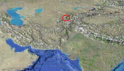
Location of the Pamir-Alay mountains.
I spent 1991/92 working in Cambridge, one of the most flat and generally unmountainous places in existence, and by the end of the year I was desperate for some proper mountaineering. I had also accumulated enough cash to consider something exotic and spent many Saturday afternoons browsing the Lonely Planet guides in Cambridge's bookshops. The Himalayas seemed the best bet, but just as I was about to actually buy a Lonely Planet book a better offer turned up.
Kirill Kuzanyan was a postgraduate physics student at Moscow State University. Kirill was one of the first Muscovites to use electronic mail, and he was using it to advertise the possibility of joining a group of Russians for a trip to Central Asia. I was intrigued by the idea, and after a great deal of discussions I arranged to join Kirill and his friends for their trip.
Location of the Pamir-Alay mountains.
Our destination was the Pamir-Alay mountains, which lie on the border of Tadjikistan and Kirgizia. Further East lie the Tien-Shen mountains and China, and to the South lie the Pamirs proper, the Hindu Kush and Afghanistan. I flew to Moscow, but for the equally long journey from Moscow to our destination we went by train. This took three days and three nights, passing through Russia, Kazakstan and Uzbekestan before reaching Leninabad (since renamed!) in Tadjikistan. On the way we crossed the Ural river which marks the border between Europe and Asia, journeyed alongside the Aral Sea (which was no more than a couple of puddles) and watched camel caravans crossing the desert alongside the railway. The trans-siberian is nothing compared to this train journey!
Three bus rides and one lorry ride later we were ready to start.
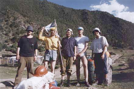
About to set off. Left to right, Kostya, Valody, Kirill, Alexey, and me.
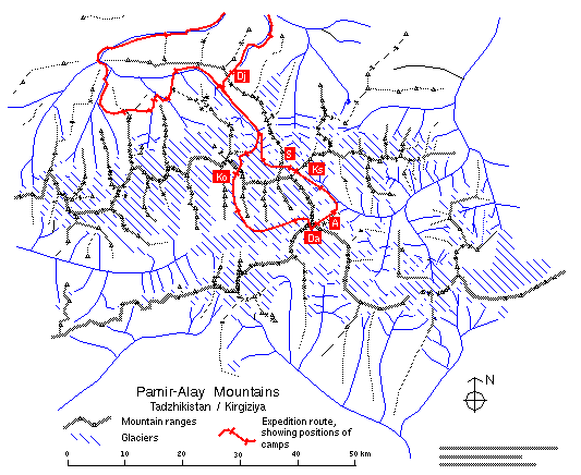
Our route. Most of our high level walking involved the circumnavigation of a group of 5000m mountains. This was followed by a long walk out. We crossed six passes over 4000m, and spent a total of 23 days beyond civilisation.
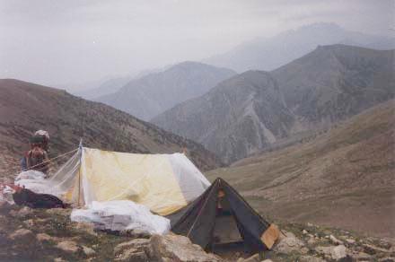
Our second night's camp, just below the Djiptik pass at 4050m (Dj on map). I was pleased to discover that the altitude had little effect on me. Two of us slept in my little tent (foreground), and the other three slept in the home-made tent behind.
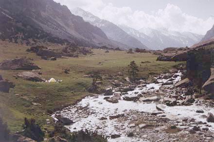
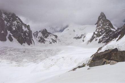
The valley at the other side of the Djiptik pass. We spent a couple of days walking up this valley to the glacier.
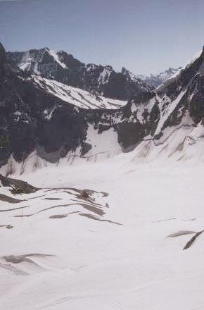
Our first day on snow. This is just before crossing the Schurovskogo pass (4400m) (S on map), which was fairly straightforward.
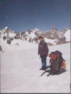
Look at the size of my rucksack. It contained
|
Tent Sleeping bag Carrymat Ice axe |
Crampons Clothes Climbing harness Assorted ironwork |
Camera 3kg of sugar cubes 3kg of sweets 1kg of preserved meat |
1kg of dried fruit 2kg of instant mashed potato 0.5kg of "porridge cakes" 2kg of solid fuel |
The view ahead from the Schurovskogo pass to the Kshemish pass (4300m) (Ks on map). The Kshemish was something of a nightmare; it was very steep on the side we climbed and we spent a night tied in to the rock half way up.
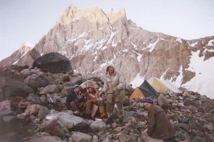
Camping on the morraine.
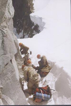
Preparing to ascend to the Ailanish pass (4500m) (A on map). This was one of the longest ascents, over two days.
The second day's climbing about to start.
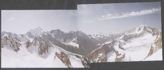
The view southwards from the Ailanish pass.
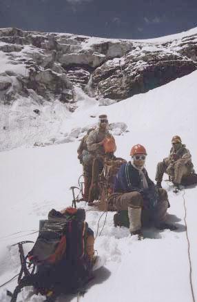
Preparing to descend the Darapioz pass (4500m) (Da on map). I was a little concerned about the prospect of an 80m abseil over a cornice!
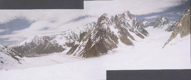
The view ahead from the Darapioz pass.
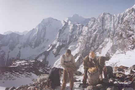
Pyramid Mountain. The highest point we reached was the Korolyova pass (4950m) (Ko on map), which is just to the right of Pyramid Mountain.
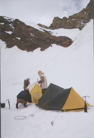
Our highest camp, at around 4800m, just below the Korolyova pass. Note how my tent is held up by ice screws and axes.
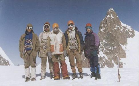
The summit photo, 4950m, Pyramid Mountain behind.
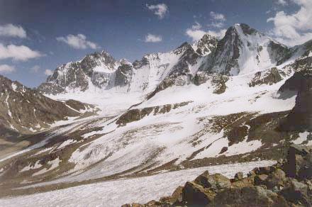
The view down from below the Korolyova pass. Our trip had essentially circumnaivigated these mountains.
All in all it was an incredible trip and I'd encourage anyone who has the chance to do something like this to go for it. Unfortunately the political situation in the central Asian republics makes visits to this area awkward at the moment. But there are other places!
| Photo Gallery | ChezPhil.org | Search | Site Map | Feedback |
© 1998, 1999